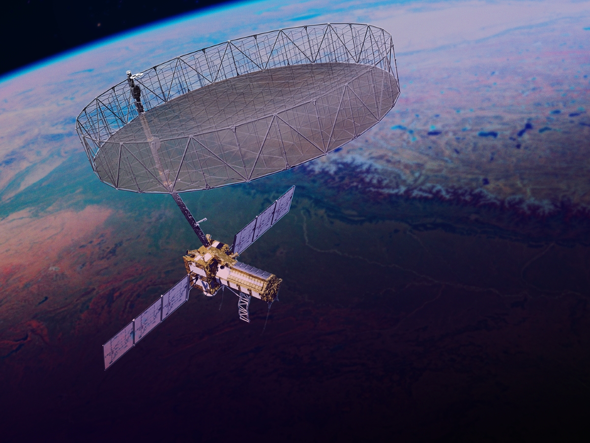
A first-of-its-kind satellite just launched into space to map our planet at an unrivaled level of detail, and Texas Engineer Jingyi “Ann” Chen will play a key role in the direction of this ambitious mission.
Chen, an associate professor in the Department of Aerospace Engineering and Engineering Mechanics, joined the operations science team of the NASA-ISRO Synthetic Aperture Radar (NISAR) satellite mission. Launched in July, the satellite will track the motion of ice sheets and glaciers, land deformation due to earthquakes, volcanoes and landslides, as well as changes in forest and wetland ecosystems down to fractions of an inch. It will also aid decision-makers in fields as diverse as disaster response, infrastructure monitoring and agriculture.

“I’m a radar scientist; my whole career is about using radar data to learn more about the Earth,” said Chen, an affiliate faculty member in the Center for Space Research (CSR) at UT. “I’ve gotten so much from NASA data over the years, and now it’s time to do something in return to help deliver this data in an accessible way for everyone to use.”
The NISAR operations science team consists of dozens of leading experts across several Earth science disciplines. Starting next year, Chen will be part of the solid Earth team, focusing on calibration and validation of the algorithms for data collection and sharing.
NISAR is a joint effort between NASA and the Indian Space Research Organization. The satellite, which launched from India on July 30, will rapidly orbit the Earth, gathering new samples every 12 days. It will be able to measure changes on the surface as small as a few millimeters.
Chen’s NISAR work adds to the long list of space missions with CSR involvement. Dating back more than 50 years, aerospace engineering faculty, through CSR, have participated in more than 15 missions.
Perhaps the most famous is the Gravity Recovery and Climate Experiment (GRACE) mission, a 2002 collaboration between U.S. and German space agencies that sent a pair of satellites to space to observe key changes in the planet’s hydrological systems, oceans, ice sheets and solid Earth. Texas Engineer Byron Tapley served as the lead investigator of this mission, which spawned a successful sequel in 2018 and another launch planned for 2028.
Most recently, current CSR director Lori Magruder played a key role in NASA’s Ice, Cloud and land Elevation Satellite (ICESat-2) mission for more than a decade, leading the science team at one point.