
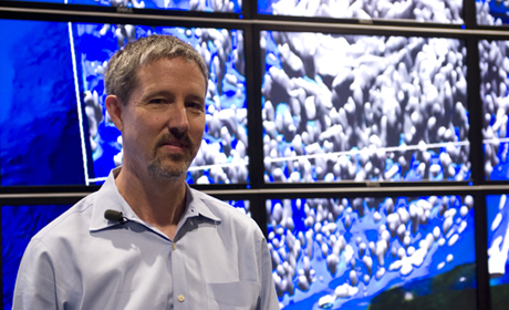
 Clint Dawson's storm surge models are helping the state better prepare for and react to hurricanes.
The beginning of hurricane season passed by quietly earlier this summer, but for researchers at the Cockrell School of Engineering and the Institute for Computational Engineering and Sciences (ICES) it marks the start of a six-month waiting period over what waves and winds may churn up in the Gulf of Mexico.
Researchers are ready, however, thanks to sophisticated computer simulations developed by faculty and enabled by Ranger and Lonestar, two of the world's most powerful supercomputers located at the Texas Advanced Computing Center on campus. In recent years, research there and at the Cockrell School has helped improve the way hurricanes are forecast, and simulation models developed by faculty have helped predict everything from how coastal regions to oil from the Deepwater Horizon spill are impacted by hurricanes.
The research, spearheaded by aerospace engineering and engineering mechanics Professor Clint Dawson and Dr. Gordon Wells of the Center for Space Research at The University of Texas at Austin, is playing a pivotal role in how the state plans for, and responds, to hurricanes. Following the demonstrated success of Dawson’s storm surge prediction models post-Hurricane Katrina and before and after Hurricane Ike in 2008, he and Wells are helping to shape policy and improve planning for population and infrastructure growth in Texas. More importantly, they are helping to increase the safety of thousands of residents living along the Texas coast.
“We recognize that no matter what we do, we can't devise a full-proof protection system – there's always going to be gaps in situations that we've never encountered and we don't know what will happen in the future,” said Dawson, who also heads the Computational Hydraulics Group at ICES. “All signs point to the fact that we may have fewer hurricanes in the future, but the ones we have will be bigger and more intense. Certainly, we've seen that in the last few years.”
Research and interest grows as hurricanes intensify
The basic technology to predict the effects of hurricanes on the coast has been around since the 1970s, but the ability to use high resolution models – models that, like Dawson's, are so detailed they can predict down to the neighborhood level in a city whether flooding will be at 5 feet or 25 feet – has only slowly developed in the last 17 years.
Aside from technology advancements that had to happen during that time, Dawson said hurricanes received little attention prior to then because, simply put, there weren't many of them. That is until Hurricane Andrew in 1992, followed by Hurricane Katrina – the costliest natural disaster and one of the most deadly – devastated coastal cities in 2005.
Working in collaboration with faculty at the University of North Carolina in Chapel Hill and the University of Notre Dame, Dawson and researchers developed the ADCIRC storm surge model, which accurately predicted and simulated flooding from Katrina after the storm. The storm surge predictions for the Louisiana and Mississippi coasts were so precise that they were within only a foot of error or less over what actually occurred during the storm.
Katrina highlighted significant holes in federal and state agencies’ ability to predict and prepare for major storms.
Soon after, Dawson was approached by operations and emergency management officials in Texas, where Wells was providing the state with technological guidance as it reorganized its operating procedures during emergency situations. State officials were interested in using Dawson’s models to help guide emergency evacuation in Texas the next time a hurricane hit.
Unknown to them, it wouldn’t be long.
Responding to the call for help
Dawson’s models use an automated computing system that, every six hours when they are available, downloads hurricane forecast advisories from the National Hurricane Center and the National Oceanic and Atmospheric Administration.
Faculty and students then input variables affecting the path of the hurricane, such as wind direction, wind speed and atmospheric pressure, to generate a storm surge prediction model that forecasts the maximum water level over the life of the hurricane.
“Once we get weather advisories, we can make the prediction within two hours – a number that's pretty fast and pretty good,” Dawson said. “Because it's a high resolution image we're giving them, it's very detailed. We wouldn't have been able to do this five years ago because we didn't have the computer power.”
When Ike developed as a tropical disturbance in the Atlantic, researchers quickly began modeling how the storm would impact the Texas coast if it hit.
Before the category 2 hurricane made landfall, Dawson and researchers developed updated prediction models while Wells helped coordinate emergency management plans with the chief of the Texas Division of Emergency Management and Gov. Rick Perry.
“We had satellite data so we could actually tell that the models were correct. In the early hours of Sept. 13, I knew that basically we had responded to the correct data and the impacts that had been forecast had actually occurred,” Wells said.
Dawson said researchers were forced to quickly scramble and improve a still-developing technology during Ike, but the progress achieved during the experience has made them more prepared should another large hurricane hit.
For the one research assistant and 11 doctoral, postdoctoral and undergraduate students working on the models, the opportunity has allowed them to see the impact of their research.
“The amazing part of this is to think of people being evacuated safely and out of dangerous areas because of our storm prediction models,” said Nishant Panda, a graduate student in aerospace engineering and a research assistant at ICES.
Expanding uses of research and faculty expertise
But the models have more applications than just hurricanes. Because Dawson and his colleagues had access to highly accurate representations of the Louisiana, Mississippi and Texas coastlines due to their hurricane storm surge research, they and Wells were called upon to simulate the impact of BP's massive Gulf of Mexico oil spill on coastal areas.
One of the chief concerns and research interests by the National Science Foundation and Department of Homeland Security was over the possibility that a hurricane moving through the gulf would bring oil inland to marshes, channels and wetlands.
Dawson and Wells responded by providing real-time satellite images of the oil spill to 30 relief agencies. Using the Center for Space Research‘s three rooftop antennas that receive regular satellite photos from the 14 American and international satellites passing over the Gulf, Wells provided images three hours faster than NASA.
"These images are critical because a lot of the operational plans are based upon receiving these early images we get by direct broadcast," Wells told Austin’s NBC TV news affiliate at the time.
Dawson’s models also forecasted the oil’s behavior in the event of a hurricane – information that could have helped guide emergency responders had one occurred. Because of the nature and disorganization among multiple agencies, the models were not used in real-time, Dawson said.
“That was our hope, but things were too chaotic at the time,” Dawson said. “Going back and looking at this in hindsight, we were doing basic research. We were trying to learn how to take satellite images and meteorological data to do oil spill tracking.”
“We learned a lot after the spill even though we weren’t necessarily instrumental in terms of directing how to make decisions,” Dawson said.
But just like Ike prepared them to be better positioned for hurricanes, the BP spill has made them better prepared to model oil spills. While both are major points of research, Dawson isn’t hoping for either in the next six months.
Clint Dawson holds the Edward S. Hyman Endowed Chair in Engineering, The Joe King Professorship, and the Ernest and Virginia Cockrell Chair in Engineering.


