
A new case study using computational modeling predicts minimal effects on increasing hurricane storm surge in surrounding Texas Gulf Coast communities as a byproduct of proposed depth increase of the Corpus Christi Ship Channel near Aransas Pass.
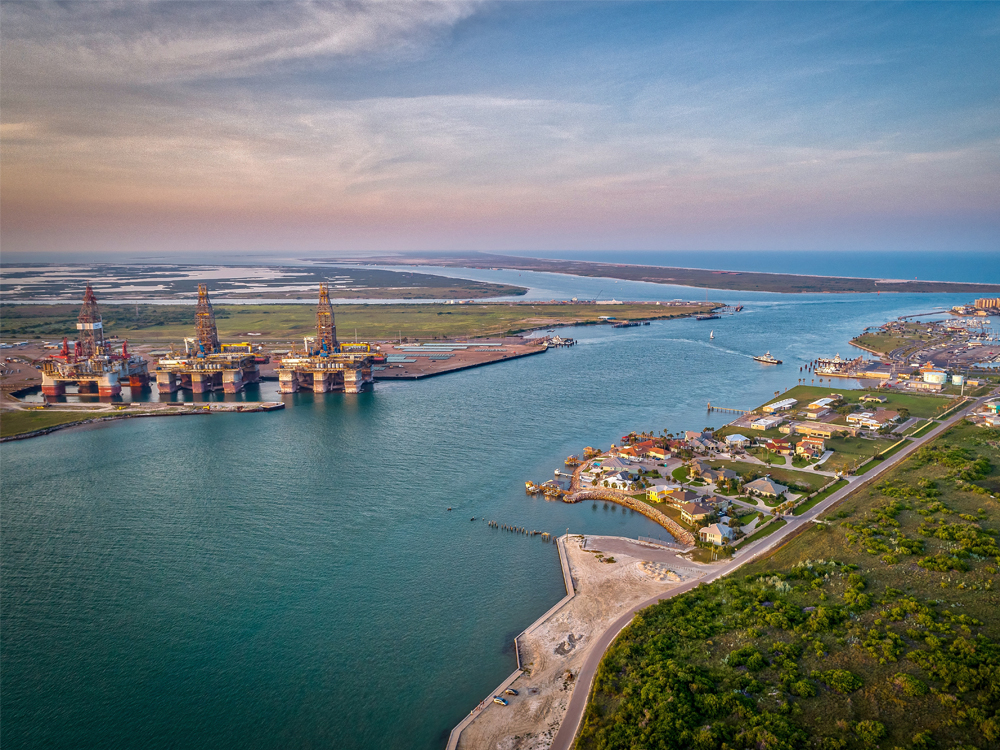
The study, published in the Journal of Computational Science, focused on the portion of the ship channel near Aransas Pass, a primary access point for commercial vessels to enter and exit the system of bays between the Gulf of Mexico and the Port of Corpus Christi. This natural tidal inlet divides Mustang Island and San José Island, and are protective barrier islands to mainland Gulf Coast communities. Researchers at the Cockrell School of Engineering and the Oden Institute for Computational Engineering and Science utilized computing resources at the Texas Advanced Computer Center (TACC) for their findings.
The Port of Corpus Christi located south of Houston is the nation’s largest U.S. energy export gateway and third largest seaport in total waterway tonnage in the country, according to their website. As part of a larger project to accommodate industry growth, it has been proposed to deepen the ship channel through Aransas Pass near Harbor Island to 70 ft. (21.33 m), from its current average depth of 47 ft. (14.33 m), which would allow for very large crude carriers (VLCCs) to access the port more easily. However, there is community concern that a deeper channel could affect the seawater flow through the channel and the bays behind it, which has environmental, recreational, and commercial interests for the surrounding communities.
Professor Clint Dawson, department chair of the Department of Aerospace Engineering and Engineering Mechanics and director of the Computational Hydraulics Group (CHG) at the Oden Institute, and research associate Eirik Valseth, collaborated with Edward Buskey, director of The University of Texas Marine Science Institute in Port Aransas, Texas to predict what effect deepening the channel could have on area storm surge during a hurricane. Valseth emphasized that this research is independent of the current ship channel expansion project.
Their investigation is based on numerical mathematical models of the circulation of coastal water due to Hurricane Harvey which impacted the Texas coast in August 2017 and a synthetic hurricane derived from Harvey.
According to Valseth – whose research focuses on flood modeling, including storm surge – the computational model results were counter to what was initially suspected, which was that a deeper channel would allow more water to enter the region behind Aransas Pass.
“In most of the region we noticed that a deeper channel would reduce the peak storm surge based on the model results. Closer investigation of hurricane wind fields and the results showed that indeed more water was allowed to pass through the channel, however, this is a two-way street. A significant amount of surge originates in the large shallow bays behind the Aransas Pass due to the counterclockwise rotating wind field of a hurricane. Hence, the deeper channel is also able to drain out this surge more easily than a shallow channel,” said Valseth.
Read the full Oden Institute story »Read the full Oden Institute story »


